
Cascais' pioneering spirit and innovative charisma are evident in GeoCascais, the municipality's georeferenced information platform, a success story in the digital transformation of the municipal public sector, which has been at the forefront of digital transformation for 17 years.
Explore the GeoCascais website here
In the 1990s, the first steps were taken towards finding a solution for collecting and aggregating data digitally. The dispersion of information led to delays and inefficiency in responding to citizens, especially in the area of town planning.
New paradigms and challenges quickly led to the need to implement a more agile, efficient and reliable system. The creation of an integrated, geo-referenced database in 2007 represents a strategic turning point, continuing a journey based on an innovation ecosystem, with a powerful tool for urban management and decision-making.
GeoCascais is now a case study in the process of learning and investing in municipal governance. Over the course of almost two decades, in a process of continuous development, a more robust and adaptable tool has been tested and built to meet the needs of the municipal environment.
The year 2024 ends with the project moving to a new level, with most of its components based on open-source solutions, which allows for greater interoperability, control and a significant reduction in licensing costs.
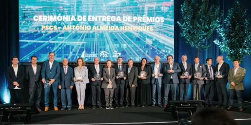
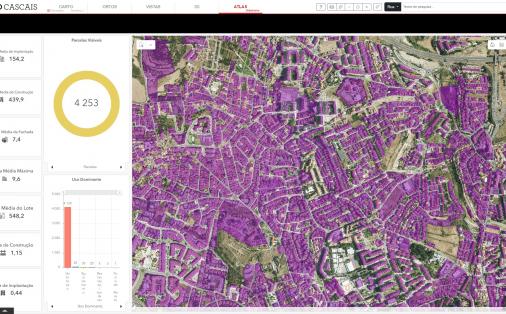
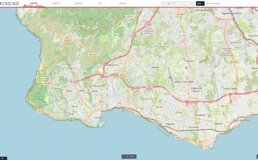
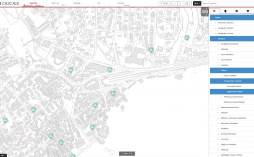
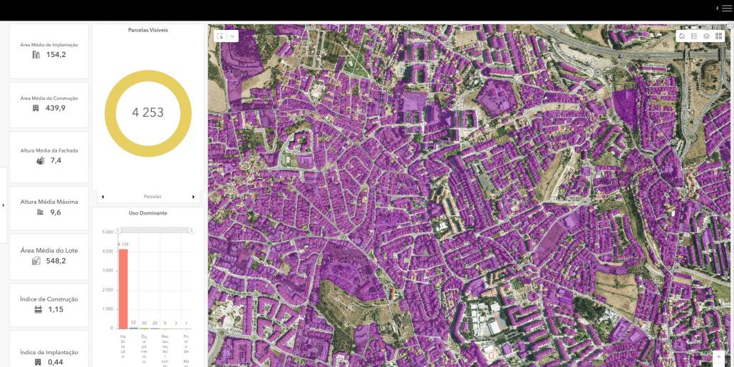
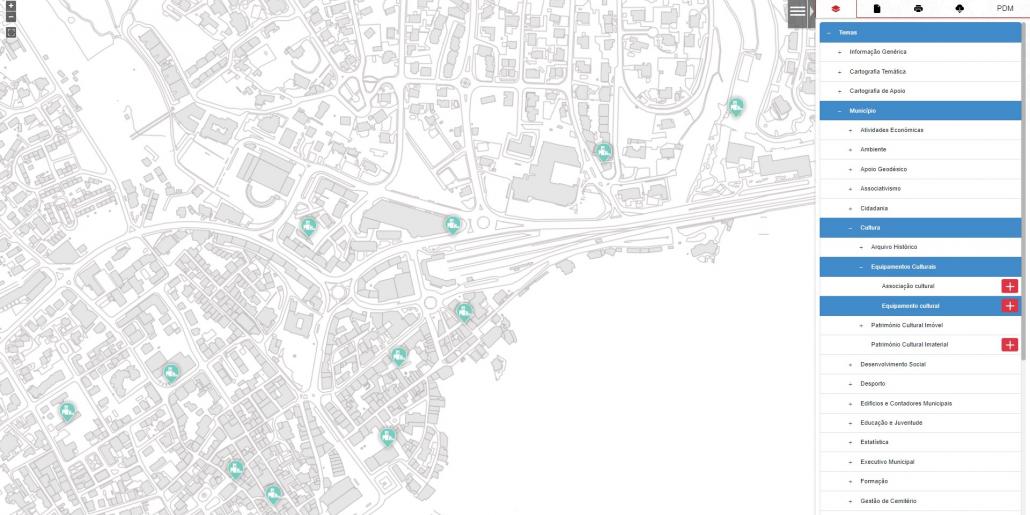
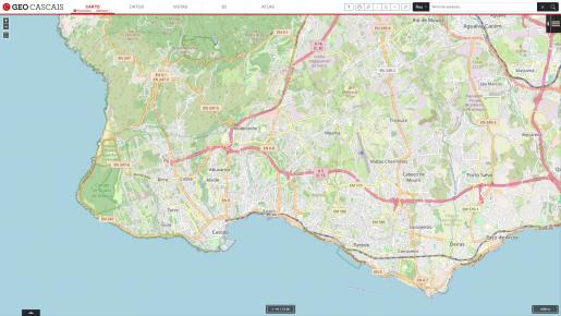
This track record recently led to public recognition with the ‘Portugal Smart Cities Award, António Almeida Henriques’, in the ‘Digital Transformation’ category. GeoCascais identifies itself as a technologically advanced platform that brings together different types of information: cartographic, geographic, cadastral, urban planning, etc.
The platform is an ally in municipal management. It facilitates decision-making, project execution, publication and dissemination of information, making municipal processes more efficient. Externally, it serves as an access point for citizens, companies and organisations interested in geographic data. The availability of this information strengthens transparency and promotes community participation in municipal management.
Issuing localisation plans and extracts from the Municipal Master Plan (PDM), which can be obtained online, without physically going to the municipal offices and free of charge, a service that previously required payment of a fee.
Data export to files in other formats: encourages participation and social innovation.
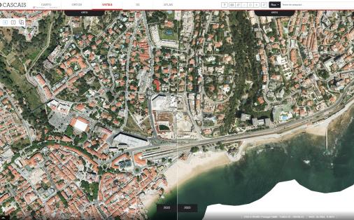
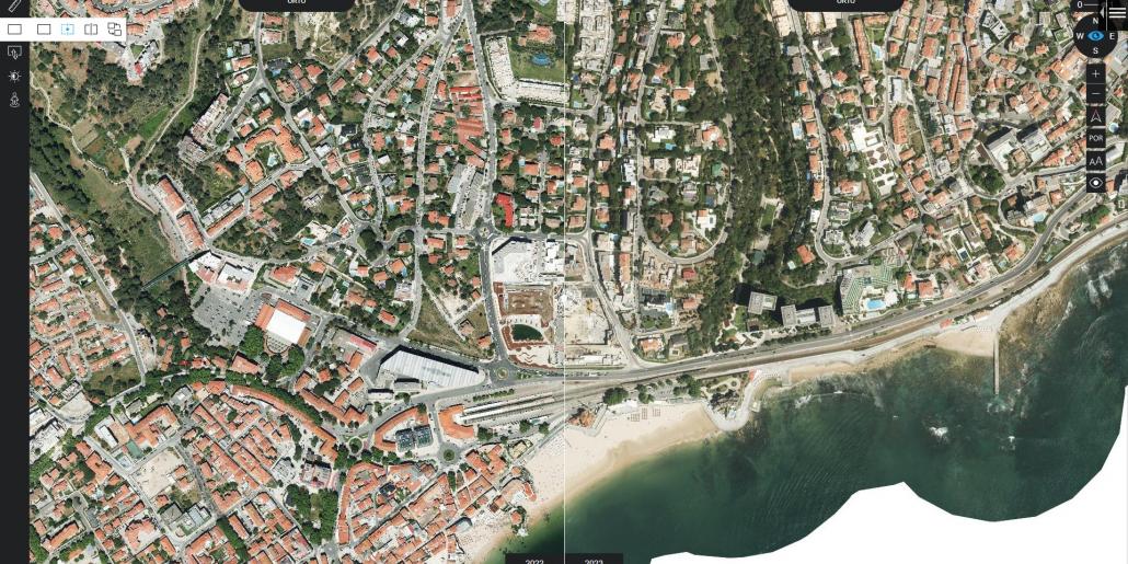
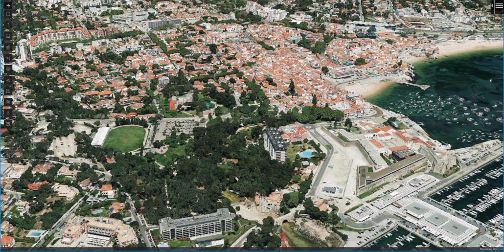
Integration of street and oblique views, which are now fully owned by Cascais City Council: this new tab makes it possible to visualise and compare the same area in different time frames.
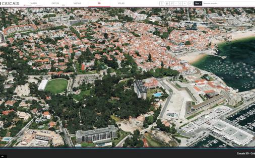
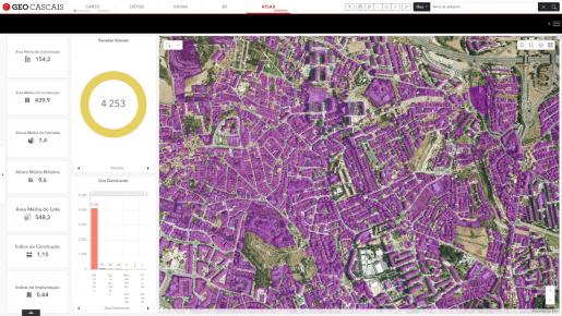
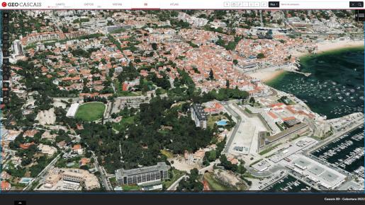
3D visualisation: the user can visualise the municipality of Cascais three-dimensionally, and can add other layers of three-dimensional information, make profile calculations, measurements, use the line of sight and daylight tools.